Haramain Train Stations
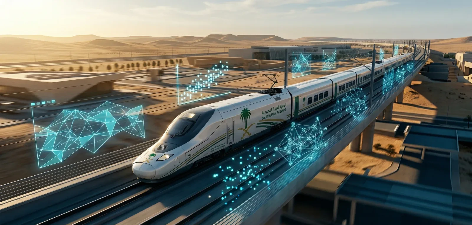
A comprehensive statistical analysis of climatic conditions across Haramain high-speed railway stations in Mecca. The study examined temperature, humidity, wind patterns, and other environmental variables to support operational and safety decisions.
Project highlights
Quick summary
When you need long-term climate trend characterization across multiple eras and records, with defensible trend tests and spatial maps.
We assembled multi-era climate records, tested trends, and mapped the results.
- Quality-controlled, analysis-ready multi-era climate dataset.
- Trend-analysis report with significance testing and effect sizes.
Methods & Tools
Characterizing long-term climate and dust-exposure trends along the Haramain corridor required harmonizing multi-decadal records and quantifying spatial patterns with defensible statistical trend tests.
Harmonized and quality-controlled climate records across 3 eras and 12 variables, screening for inhomogeneities and gaps before analysis.
Decomposed the time series and tested for monotonic change with Mann–Kendall and Sen's-slope estimators, accounting for seasonality and autocorrelation.
Modeled and interpolated spatial variation with kriging and produced corridor-wide GIS exposure maps in R (sf/terra) and QGIS.
Quality-controlled, analysis-ready multi-era climate dataset.
Trend-analysis report with significance testing and effect sizes.
Geospatial exposure maps with reproducible analysis code.
Records screened for inhomogeneity and gaps before any trend test.
Trend tests adjusted for seasonality and autocorrelation.
Spatial interpolation cross-validated (leave-one-out) for accuracy.
Reproducible R/QGIS workflow with documented data provenance.
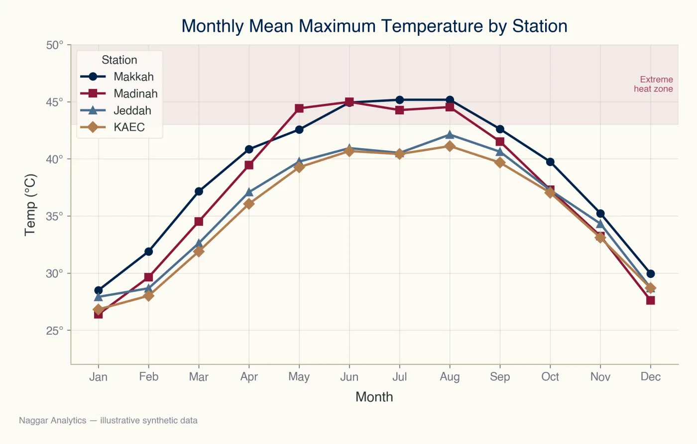
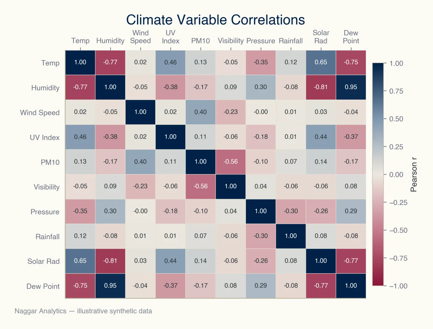
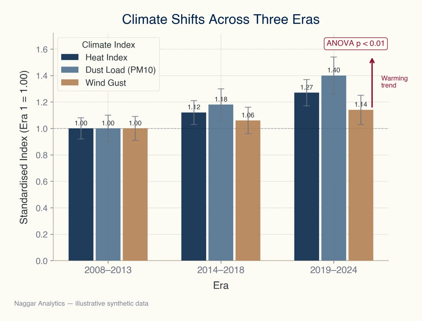
Our work was not medical at all — we were studying the climate around a national rail corridor: temperature, humidity and wind across different periods. They built the statistical analysis and the GIS maps together, and the results helped us in real operational and safety decisions. Very professional people.
Have a project to register?
Submit your project in the dashboard and we’ll map the analysis plan, deliverables, and timeline.